Geo-referencing is the process of introducing world real coordinates on to a raw image so that the final product is a spatially enabled map that can give location of features in the two-dimensional space.
Steps:
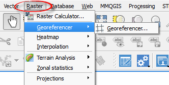
1. Click on the raster menu on the QGIS interface.
2. On the drop down content click georeferencer > georeferencer. A dialog box will appear.
The Georferencing pop up window will appear, allowing you to load a raster image.
3. Click on the button that is highlight in the image below.
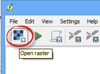
This allows you to browse to where the map is located.
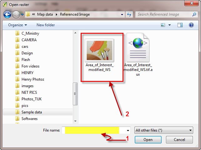
4. Select the File name you wish to georeference (Many Image formats are supported).
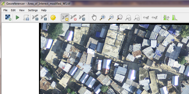
5.Click Open to load the map. The Raster Data is loaded on the Georeferening window as shown below.
6. To set
properties of georeferencing, Click the icon 
 (transformation
settings).
(transformation
settings).
A dialog box pops up so that you can set the coordinate reference system.
Identify at least two points with well-known points on the map that you will use to georeference with.
Assign at least two ground control points (GCPs) to enable the georeferencing.
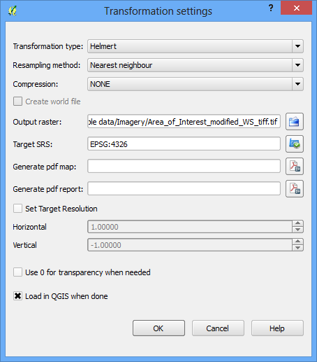
Note: Set the Transformation type as Helmert and Resampling method as Nearest neighbour so as not to change the colour code of pixel.
In the output raster, give the georeferenced image a name. Next, select the reference system to be used in Target SRS.
7. Select the Load in QGIS when done checkbox and click the OK button.
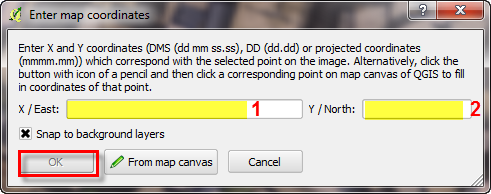
8. With identified points on the map and with their coordinates,
Use the Add Point button ( )
to add control points on the map.
)
to add control points on the map.
Once you click at any point on the map, the popup below shows up allowing you to enter the coordinates of that point.
9. Do this for the other points and then click on the OK button for each pair of points entered.
10. In
the Georeferencing popup window
toolbar, click on the Run button
( ) to load all the points.
11. Then close the georeferencer dialog box.
12. Load
the geo-referenced image using the icon  (open raster) in the QGIS interface view for viewing
the geo-referenced image.
(open raster) in the QGIS interface view for viewing
the geo-referenced image.
Note: This is one way of entering the coordinates during the geo-referencing.