31 Jul 2017 Development of a Land Information Management System (LIMS) for Turkana County- Kenya
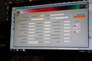
As earlier announced on this platform, the publication on the Development of a Land Information Management System (LIMS) for Turkana County- Kenya is now finalized. The publication outlines the process undertaken by GLTN partners namely UN Habitat and the United Nations Food and Agriculture Organization (FAO) Representation in Kenya to support the Ministry of Lands, Physical Planning and Urban Areas Management of the Turkana County Government, in establishing a county Land Information Management System based on the Social Tenure Domain Model (STDM).
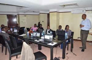
The project was carried out in the context of the United Nations Food and Agriculture Organization (FAO) program entitled, “Support for Responsible Land and Natural Resource Governance of Communal Lands in Kenya”. STDM as a tool was modified, with new features added to suit the Turkana County context. Staff from Turkana County and sub-counties was trained on the use and application of the tool to support the Ministry’s recordation and management of surveying and planning information. A customized land information management system for Turkana County was then developed, tested and rolled out according to the requirements of Ministry of Lands, Physical Planning and Urban Area Management. Technical processes were also documented to guide staff in its implementation. The county LIMS is also expected to support the development of the Turkana County Spatial Plan
STDM has had successful applications in Nairobi, Mombasa and Bomet in capturing land information in urban, peri-urban and rural settings for purposes of informal settlement upgrading, natural resources management and improvement of land tenure security. You can download the full publication on the GLTN website at gltn.net

No Comments