 ) located in STDM toolbar. A dialog box appears
allowing you to browse to the source folder of the data to be imported.
) located in STDM toolbar. A dialog box appears
allowing you to browse to the source folder of the data to be imported.Spatial Units can be imported into the STDM database from a shapefile, autoCAD or comma separated values.
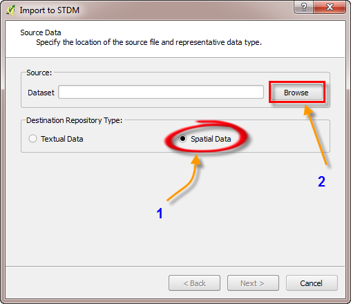
1. To import, click on the Import Data
button () located in STDM toolbar. A dialog box appears
allowing you to browse to the source folder of the data to be imported.
2. Check the Spatial data circle to enable/activate it.
3. Browse to the folder where the shape files (spatial data) is stored.
4. Go to the Sample data folder⇒Map Data⇒and select shapefiles and open the shape files
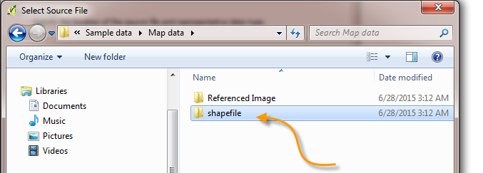
If nothing is displaying on the opened folder, make sure that the file format is in ESRI Shapefile (*.shp) as shown below.
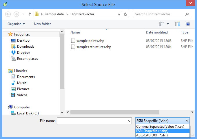
5. Select the file and Click Open.
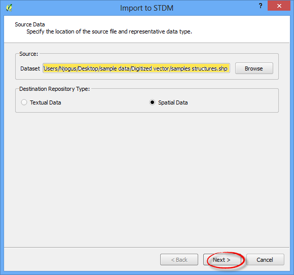
6. Click Next to continue.
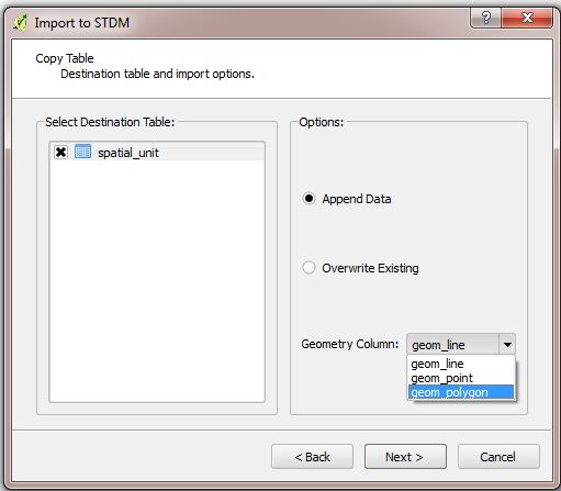
A dialog box appears allowing you to specify the destination table and the Geometry of the data being imported.
7. Select the destination table of the data by checking/enabling the Spatial_unit.
8. In the Geometry Column, a drop down list allows you to choose the data type of your data. Select Polygon
9. Click Next to continue
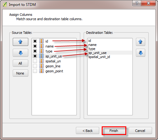
A dialog box appears allowing you to match source and destination table column. Use the "UP" and "DOWN" buttons to match the columns.
10. Click on the Finish button.
The spatial units have now been imported into the STDM database.
A notification will pop up showing you that the data has been imported successfully.